Online & Offline Maps
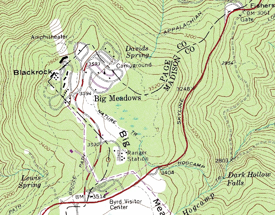
If you are a serious prepper, then one thing you probably have in your arsenal is maps of the area you live in and maps of the area you plan to bug out to. Printed maps are best, but if you have a good enough plan, then you can rely on offline digital maps. I know that I’m going to get beat up on saying digital, because everyone is going to say, “But Average Joe, an EMP would destroy your digital maps…” And yes that is true, but first, an EMP is just one of several dozen scenarios that you need to plan for and there are methods to protect your electronics from an EMP (supposedly, only a real EMP will tell).
For those who are not tin-foil hat-wearing citizens, an EMP is an Electromagnetic Pulse or a huge burst of electromagnetic energy designed to destroy electronics. An EMP can happen naturally or can be man-made. The most realistic scenario for a naturally occurring EMP is a Coronal Mass Ejection (CME). A coronal mass ejection (CME) is a significant release of plasma and accompanying magnetic field from the solar corona. They often follow solar flares and are normally present during a solar prominence eruption. The plasma is released into the solar wind and can be observed in coronagraph imagery A solar flare is a sudden flash of increased brightness on the Sun, usually observed near its surface and in close proximity to a sunspot group. Powerful flares are often, but not always, accompanied by a coronal mass ejection. Even the most powerful flares are barely detectable in the total solar irradiance (the “solar constant”).
However, there are also naturally occurring EMPs that arise from Lightning or a Lightning electromagnetic pulse (LEMP). The discharge is typically an initial huge current flow, at least mega-amps, followed by a train of pulses of decreasing energy. Another naturally occurring EMP is Meteoric EMP. The discharge of electromagnetic energy resulting from either the impact of a meteoroid on a spacecraft or the explosive breakup of a meteoroid passing through the Earth’s atmosphere.
The most possible man-made EMP would be a weapon specifically made for the purpose of disrupting the electromagnetic spectrum and causing catastrophic damage to the area where the EMP was focused. But this post isn’t about EMP it is about maps, so let’s navigate our way back to the topic (see what I did there?)
Let’s assume that you have paper maps and the digital maps are to augment your hard copies. What I wanted to talk about is where to get your maps.
If you are going to bug out in a grid-down situation, then you will need a map at some point. This is why it is important to have maps on hand either paper or digital. Here are some of my favorite resources for maps.
Topozone
There is a way to create “printed” maps from Topozone, and once you get to that point, “print” the map as a PDF, and there you have it.
https://www.topozone.com/
NatGeo Maps
NatGeo requires you to sign up (free) to use their website and it only requires an email address (so they can send you junk mail) but once you have an account, you can download any of their maps. There are two methods of using their maps. You can “print” to a PDF or you can use their mobile App. I have both PDF copies and their App installed on an old Cell phone that I have in storage.
With their Trail map feature, you can download entire quad maps of any given area – Trail Maps – https://www.natgeomaps.com/
NatGeo Digital Map & Apps – https://www.natgeomaps.com/
USGS National Geospatial Program
Building on the success of more than 130 years of USGS topographic mapping, the US Topo series is a new generation of maps of the American landscape. US Topo topographic maps are produced by the National Geospatial Program of the U.S. Geological Survey (USGS).
https://www.usgs.gov/core-
USGS National Geologic Map Database
A nice interface and has current and historical maps
https://ngmdb.usgs.gov/ngmdb/
National Parks Maps
The Perry-Castañeda Library (PCL) Map Collection website is archived as of 2021 and is no longer being updated. But they have great maps of all the National Parks
https://maps.lib.utexas.edu/
GISGeography
If you’re looking for topographic maps for the United States, the first place to look is the USGS topo maps series.
https://gisgeography.com/
Mappery
Mostly historical maps, but you might find something of interest there.
http://www.mappery.com/

Author
-

Welcome to the Average Joe Weekly blog. This is basically my place on the web where I can help spread some of the knowledge that I have accumulated over the years. I served 10+ years in the Marine Corps on Active Duty, but that was some 25 years ago.
View all posts
Welcome to the Average Joe Weekly blog. This is basically my place on the web where I can help spread some of the knowledge that I have accumulated over the years. I served 10+ years in the Marine Corps on Active Duty, but that was some 25 years ago.


